
-
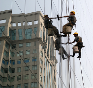
٨ نصائح للتغلب على تحديات الحرارة الشديدة في السعودية من خلال دراسة قياس الحرارة دراسة توزيع درجات الحرارة

تمثل الحرارة الشديدة في السعودية تحديًا كبيرًا للحفاظ على ظروف درجة الحرارة المثلى في المستودعات، الغرف الباردة، ووسائل النقل. تُعد دراسة قياس الحرارة أمرًا بالغ الأهمية لضمان سلامة وجودة المنتجات الحساسة للحرارة. تقدم شركة Eximia360، الرائدة في حلول قياس الحرارة في السعودية، الرياض، جدة، والدمام، خبرة واسعة لمساعدة الشركات على مواجهة هذه التحديات. (www.eximia360.com) ١.…
-
٧ طرق لتقليل الهدر في عمليات التجزئة بالرياض من خلال دراسة قياس الحرارة دراسة توزيع درجات الحرارة
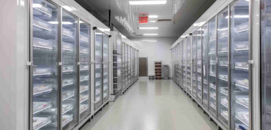
في مناخ الرياض الصعب، يُعد الحفاظ على درجات الحرارة المثلى في بيئات التجزئة أمرًا بالغ الأهمية لتقليل هدر المنتجات وضمان رضا العملاء. تقدم شركة Eximia360، الرائدة في خدمات دراسة قياس الحرارة في السعودية، الرياض، جدة، والدمام، حلولًا شاملة لمساعدة تجار التجزئة على تحقيق هذا الهدف. (www.eximia360.com) ١. تحديد النقاط الساخنة والباردة تتضمن دراسة قياس الحرارة…
-
7 Ways Temperature Mapping Reduces Waste in Riyadh Retail Operations
In Riyadh’s challenging climate, maintaining optimal temperatures in retail environments is crucial to minimize product waste and ensuring customer satisfaction. Eximia360, a leading provider of temperature mapping study services across Saudi Arabia—including Riyadh, Jeddah, and Dammam—offers comprehensive solutions to help retailers achieve this goal. 1. Identifying Hot and Cold Spots Temperature mapping studies involve placing…
-
الطاقة على الحافة: تأثير دراسات رسم الخرائط الحرارية على مرافق الطاقة المتجددة في المملكة العربية السعودية دراسة توزيع درجات الحرارة
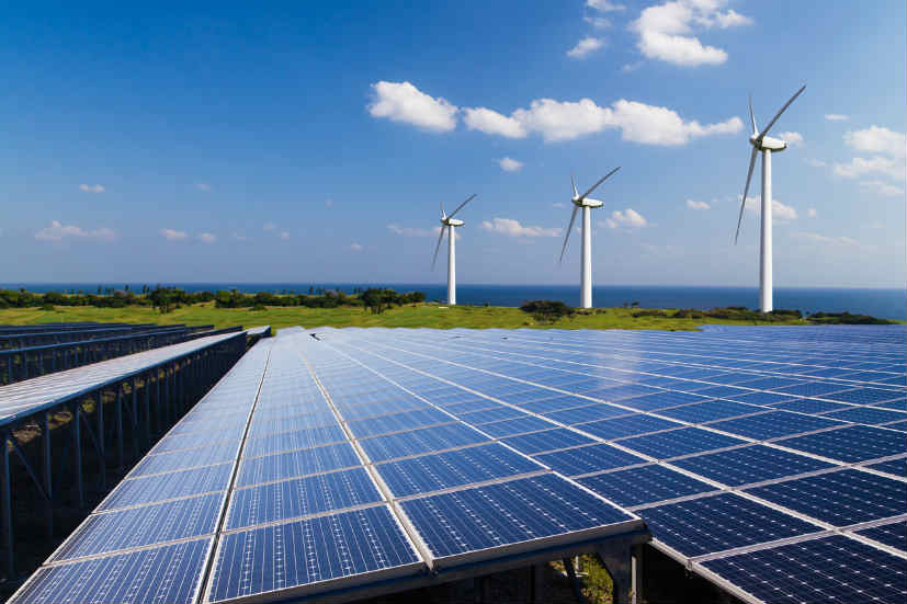
تستثمر المملكة العربية السعودية بشكل واسع في مشاريع الطاقة المتجددة ضمن استراتيجيتها الطموحة رؤية 2030، حيث يتم إنشاء محطات طاقة شمسية ومزارع رياح ومرافق لتخزين الطاقة في مختلف أنحاء البلاد. هذه المشاريع ليست مجرد خطوات نحو تقليل الاعتماد على النفط، بل هي أساس لبناء مستقبل مستدام ومرن للطاقة. ومع ذلك، فإن المناخ الصحراوي القاسي يمثل…
-
Energy on the Edge: The Impact of Temperature Mapping on Saudi Arabia’s Renewable Energy Facilities
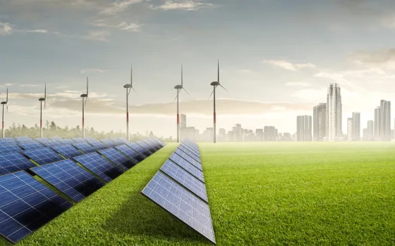
Saudi Arabia is investing heavily in renewable energy as part of its Vision 2030 strategy, with ambitious projects in solar farms, wind power, and energy storage facilities across the Kingdom. These projects are not only central to reducing dependence on oil but also to building a sustainable and resilient energy future. Yet, the harsh desert…
-
التوأم الرقمي ورسم الخرائط الحرارية: بناء مدن افتراضية للتحكم الذكي في الحرارة دراسة توزيع درجات الحرارة
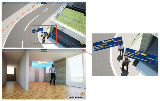
تشهد المملكة العربية السعودية تحولًا هائلًا نحو المدن الذكية، حيث يتم تطوير مشاريع كبرى في الرياض، جدة، والدمام. هذه المدن لا تقتصر على المباني الحديثة والتقنيات المتقدمة، بل تهدف إلى تحقيق استدامة طويلة الأمد وقدرة على مواجهة المناخ الصحراوي القاسي. وفي صميم هذا التحول يأتي الدمج بين التوأم الرقمي (Digital Twins) ودراسات رسم الخرائط الحرارية…
-
Digital Twins & Temperature Mapping: Building Virtual Cities for Smarter Heat Control
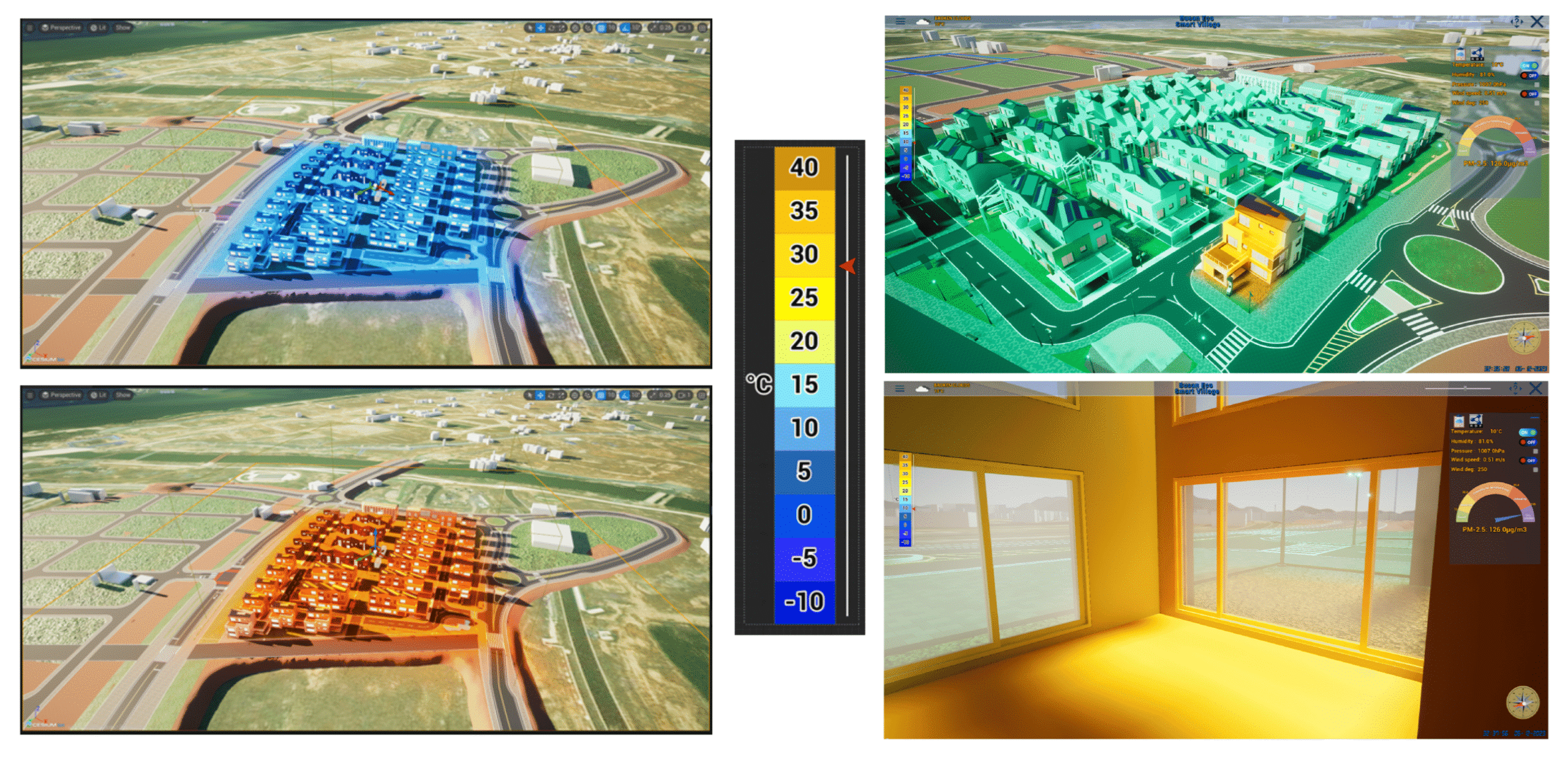
The Middle East, and particularly Saudi Arabia, is rapidly evolving into a hub for smart city innovation. With mega projects in Riyadh, Jeddah, and Dammam, the Kingdom is redefining what future-ready urban spaces look like. At the heart of this transformation lies a powerful combination: digital twins and temperature mapping studies. Together, they are creating…
-
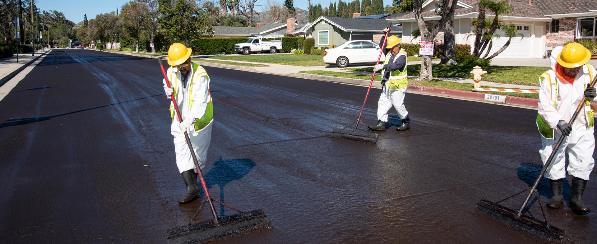
الطرق الحارة: دور دراسات رسم الخرائط الحرارية في حماية الأسفلت والبنية التحتية للنقل دراسة توزيع درجات الحرارة
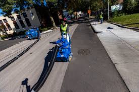
تُعد مشاريع البنية التحتية في المملكة العربية السعودية العمود الفقري للنمو الاقتصادي والتطور الحضري. فالطرق السريعة والجسور والشبكات الحديثة تربط بين مدن كبرى مثل الرياض، جدة، والدمام، مما يعزز التجارة والسياحة والتنقل اليومي. لكن من أبرز التحديات التي تواجه هذه المشاريع هو المناخ الصحراوي القاسي، حيث تؤدي درجات الحرارة المرتفعة إلى إتلاف الأسفلت والتأثير على…
-
Hot Roads: Using Temperature Mapping to Protect Asphalt and Transportation Infrastructure
Saudi Arabia’s ambitious infrastructure development is the backbone of its economic growth and modernization. Highways, bridges, and expressways connect major cities like Riyadh, Jeddah, and Dammam, facilitating trade, tourism, and daily commuting. However, the kingdom’s desert climate—with its soaring temperatures—presents a significant challenge: heat damage to asphalt and transportation infrastructure. Here, temperature mapping studies play…
-
مستقبل resilient: كيف تدعم دراسات خرائط درجات الحرارة أهداف الاستدامة لرؤية السعودية 2030 دراسة توزيع درجات الحرارة

مع تسارع وتيرة التحول في المملكة العربية السعودية نحو مستقبل أكثر استدامة، تبرز دراسات خرائط درجات الحرارة (Temperature Mapping Studies) كأداة أساسية لدعم رؤية السعودية 2030. هذه الدراسات لم تعد مجرد خدمة تقنية، بل أصبحت جزءًا محوريًا من تحقيق الكفاءة في استهلاك الطاقة، الحفاظ على جودة المنتجات، وضمان بيئة أكثر أمانًا واستدامة للأجيال القادمة. ما…
Search
Archive
Recent Posts
- مقارنة بين أنظمة المراقبة اللاسلكية لدرجات الحرارة ومسجلات البيانات التقليدية: أيهما الأفضل؟ دراسة توزيع درجات الحرارة
- Wireless Temperature Mapping Monitoring vs Traditional Data Loggers: Which is Better?

- الأخطاء الشائعة في دراسة توزيع درجات الحرارة التي تؤدي إلى فشل التدقيق دراسة توزيع درجات الحرارة

- Common Temperature Mapping Mistakes That Lead to Audit Failures

- دراسة توزيع درجات الحرارة في غرف ثبات المستحضرات الصيدلانية: دليل شامل دراسة توزيع درجات الحرارة

Gallery