

As cities continue to grow and evolve, one major challenge stands out—urban heat zones. These are areas within cities that experience significantly higher temperatures than surrounding rural zones due to dense infrastructure, limited vegetation, and human activity. Understanding and addressing these heat zones is vital for building livable, sustainable cities. This is where temperature mapping studies become essential tools in the hands of urban planners and environmental experts.
At Eximia360, we specialize in delivering accurate temperature mapping studies across Saudi Arabia, including Jeddah, Dammam, and Riyadh. Our mission is to help city officials and developers identify heat-prone areas and implement effective cooling strategies based on real, actionable data. Learn more at www.eximia360.com.
What Are Urban Heat Zones?
Urban heat zones, also known as urban heat islands (UHIs), occur when buildings, roads, and other infrastructure absorb and retain heat, causing higher temperatures compared to surrounding areas. This effect can increase cooling costs, contribute to air pollution, and negatively impact public health.
To combat these issues, cities must first identify the problem areas—and that’s exactly what a temperature mapping study helps achieve.
The Power of Temperature Mapping Studies
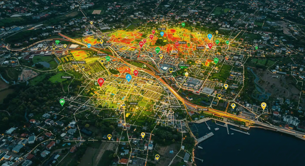
A temperature mapping study involves the collection of temperature data across different zones of a city using sensors, satellite imagery, or drones. These studies help to:
- Pinpoint high-temperature zones in real time
- Analyze the causes behind localized heat build-up
- Track changes over time for long-term planning
- Develop smart, data-driven cooling strategies
By using this data, city planners can make informed decisions about where to plant more trees, install reflective surfaces, or create green rooftops. Without this information, planning efforts may be inefficient or ineffective.
At Eximia360, we bring this data to life. Our specialized team conducts precise temperature mapping studies tailored for urban environments in Jeddah, Dammam, Riyadh, and throughout Saudi Arabia.
Real-World Applications in Saudi Arabia
Cities like Riyadh, with their rapid urban growth and extreme summer temperatures, greatly benefit from temperature mapping studies. By identifying heat pockets, Eximia360 helps authorities implement shaded areas, cooling corridors, and green infrastructure in the right places.
In Jeddah, where humidity combines with heat to create uncomfortable urban living conditions, our temperature data supports smarter building orientation and material selection.
Dammam, located in the Eastern Province, is another city that has benefitted from Eximia360’s temperature mapping services. With the data we provide, local authorities can address public comfort, reduce energy usage, and meet sustainability goals more effectively.
Why Choose Eximia360?
Eximia360 is a trusted name in environmental analytics and urban climate solutions. We offer comprehensive temperature mapping studies that help cities tackle the challenges of heat zones head-on. Our services are fully available in Saudi Arabia, including Riyadh, Jeddah, and Dammam.
When you work with Eximia360, you benefit from:
- Advanced temperature sensing technologies
- Detailed heat maps and reports for your city
- Customized recommendations for heat mitigation
- Full-service support from planning to implementation
To see how temperature data can transform your city planning, visit www.eximia360.com.